Escarpment Track guide
From Wellington: Kapiti Island Nature Reserve Day Trip
How long is the Escarpment Track?
The full track runs about 10 km one-way between Paekākāriki and Pukerua Bay on the Kāpiti Coast, taking 4-5 hours at a moderate pace with genuine elevation gain and two notable suspension bridges. It's a proper day walk rather than a casual stroll, best tackled by fit walkers with a plan for the return journey by train.
A cliff-edge day walk up the coast
The Escarpment Track is one of the more genuinely dramatic day walks within easy reach of Wellington, tracing the steep coastal hills between Paekākāriki and Pukerua Bay on the Kāpiti Coast, roughly 40 minutes’ drive or under an hour by train north of the city. Unlike the gentler rail-trail-style walks closer to Wellington itself, this is a proper hiking track — steep climbs, genuine cliff-edge exposure in places, and two suspension bridges crossing deep coastal gullies — built specifically as a walking-only alternative to the busy State Highway 1 corridor it runs alongside.
| Distance | About 10 km one-way, Paekākāriki to Pukerua Bay |
| Time needed | Around 4-5 hours at a moderate pace |
| Difficulty | Moderate to challenging, steep sections and cliff exposure |
| Getting there | Train around 50-55 min from Wellington, or drive around 40-45 min |
| Best time | September-May, checking the wind forecast on the day |
The route in detail
The full track runs approximately 10 km one-way, climbing from near sea level at either end up onto the exposed escarpment itself, with sweeping views out over Kāpiti Island and the Tasman Sea on clear days. Most walkers take 4-5 hours to complete the full distance at a moderate pace, factoring in stops at the two suspension bridges and the steeper sections, which demand a genuine physical effort rather than a leisurely stroll.
The track was built partly to take pressure off the coastal road below during its widening works, and it shows in the quality of the infrastructure — well-formed steps and boardwalks through the steepest sections, clear signage, and those two suspension bridges as genuine engineering highlights rather than an afterthought.
The suspension bridges
Both bridges cross substantial gullies partway along the route, swaying gently underfoot as you cross and offering some of the best photo opportunities on the whole track, with views down to the valley floor and out to the coast beyond. They’re a highlight for most walkers, though anyone with a strong aversion to heights or swaying structures should know about them in advance rather than being surprised partway through the walk.
Getting there: train beats car for a one-way walk
Because the track runs point-to-point between Paekākāriki and Pukerua Bay rather than as a loop, the practical challenge is getting back to your starting point. This is where the regional rail line genuinely helps — both towns have their own train stations on the line connecting to Wellington, roughly 50-55 minutes from the central city, meaning you can walk one direction and catch a train back without needing to arrange a car shuttle. Most walkers park (or start) at one end, walk through to the other, and take the train back to their car or straight through to Wellington.
Driving to either end takes about 40-45 minutes from central Wellington via State Highway 1, but without a shuttle arrangement, a car limits you to an out-and-back walk from a single trailhead rather than the full one-way traverse — the train option is genuinely the more practical choice for most visitors wanting to walk the entire track.
Difficulty and who it suits
This isn’t a beginner’s walk. The climbs are steep in places, the exposed cliff-edge sections demand sure footing (particularly in wind or wet conditions), and the full distance requires reasonable fitness sustained over several hours. Walkers who’ve managed a demanding day hike before will find it very manageable; those looking for a gentler outing are better served by a shorter section from either end, or by Wellington Botanic Garden’s far gentler paths.
Wind: the main hazard here
Given the track’s exposed, cliff-top position along an already windy stretch of coast, gusts on the escarpment sections can be genuinely strong even on days that feel calm at sea level in Paekākāriki or Pukerua Bay. This matters particularly on the suspension bridges and the narrower cliff-edge sections, where a strong gust is more than an inconvenience — it’s worth checking a specific wind forecast before setting out, and turning back if conditions on the day feel unsafe rather than pushing through an exposed section in high wind.
Best time of year
Spring through autumn (September-May) generally offers the most reliable conditions, with less mud underfoot and typically calmer winds than the wetter, windier winter months (June-August). Regardless of season, an early start gives a comfortable buffer to finish before shorter daylight hours close in, particularly in winter when useful daylight can run out well before 6pm.
What to bring
Sturdy walking shoes rather than casual trainers, given the steep, sometimes loose surface on parts of the track; a windproof and waterproof layer regardless of the forecast, given how quickly conditions shift on this exposed coast; water and food for the full 4-5 hour walk, since there are no facilities along the route itself; and a fully charged phone, since mobile coverage is patchy in the deeper gully sections near the bridges. Anyone prone to overheating on exposed climbs should also read the Wellington wind survival guide and the wind packing list before setting out, since the escarpment amplifies whatever the regional forecast is already predicting.
Facilities at the trailheads
Neither trailhead has facilities along the route itself, but both Paekākāriki and Pukerua Bay have public toilets and cafés within walking distance of their train stations, useful for a coffee before setting off or a proper meal afterward. Paekākāriki’s small village centre has more choice for food than Pukerua Bay, so many walkers plan to start there and finish at the quieter end, refuelling before the walk rather than after. There is no water available on the track itself, so top up bottles at whichever trailhead café you pass through first.
Photography and the best light
The escarpment’s west-facing position over the Tasman Sea makes late afternoon the strongest light for photographing Kāpiti Island and the coastline, though this only suits walkers finishing at Pukerua Bay or doing a shorter out-and-back from that end, since starting a full one-way walk in the afternoon risks running out of daylight, particularly in winter. Morning starts give softer, cooler light and quieter trails, at the cost of some of the golden-hour drama over the water. The suspension bridges photograph well in any light, given they’re framed by the gully rather than the open coastline.
How it compares to other Wellington-region trails
| Trail | Distance | Character |
|---|---|---|
| Escarpment Track | ~10 km one-way | Coastal cliffs, exposure, two suspension bridges |
| Remutaka Rail Trail | ~19 km one-way | Gentle former rail grade, forest and river valley |
| Makara Peak | Various loops | Mountain-bike-focused, closer to the city |
| Mount Victoria | Short loops | Informal network, central, easy access |
Combining with Kāpiti Island
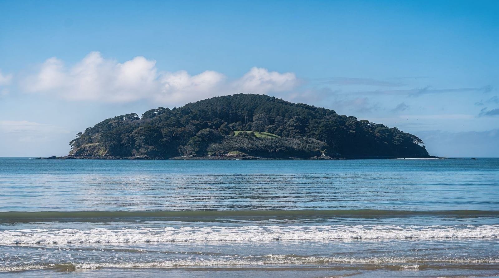
Given its location on the Kāpiti Coast, the Escarpment Track pairs naturally with a Kāpiti Island day trip for visitors spending a full day in the area, though attempting both in a single day is ambitious — the escarpment walk alone takes most of a day for the full one-way distance, and Kāpiti Island’s guided tours run to their own fixed schedules. Most visitors treat these as two separate day trips rather than combining them.
Kāpiti Island nature reserve day trip from WellingtonA different kind of Wellington-region trail
Compared with the mountain-biking-focused trails at Makara Peak or the more central, informal network at Mount Victoria, the Escarpment Track is a walking-only destination with a genuinely different character — coastal exposure, real elevation, and a sense of remoteness despite being within an hour of the capital. It’s arguably the best proper hiking day trip within easy reach of Wellington for anyone who wants more physical challenge than the city’s gentler walking options offer.
Is it worth the effort?
For fit walkers wanting a genuine, view-rich day hike without traveling far from Wellington, yes — the combination of coastal drama, the suspension bridges, and the sense of achievement from the full one-way distance make this one of the standout day walks in the wider region. It’s not for casual strollers or anyone uncomfortable with heights and exposure, and it demands proper planning around the train timetable to do the full route sensibly, but for the right walker it delivers considerably more than most short Wellington-area walks.
Doing it as two shorter walks instead
For visitors put off by the full 10 km one-way commitment, splitting the track into two shorter out-and-back walks from either end — Paekākāriki or Pukerua Bay — is a genuinely reasonable compromise, giving a taste of the cliff-edge scenery and at least one of the suspension bridges without needing the train logistics of a full one-way traverse. This suits families or less experienced walkers who want the highlight-reel version of the track rather than the complete distance.
What the track surface is actually like underfoot
The path itself is a mix of formed dirt track, timber boardwalk through the steepest and most exposed sections, and some looser gravel stretches closer to either end. It’s well maintained by Greater Wellington Regional Council, but after sustained rain, sections can get slippery, particularly the boardwalk stretches, which warrant a slower, more careful pace rather than confident striding regardless of conditions.
Comparing the view to Wellington’s own lookouts
The Escarpment Track’s views differ meaningfully from anything available within Wellington itself — where Mount Victoria and the cable car lookout both look back over the harbour and CBD, the escarpment looks out over open Tasman Sea coastline and Kāpiti Island, a genuinely different visual experience that rewards the additional travel time to reach it. Visitors who’ve already done Wellington’s city lookouts and are looking for a different kind of view entirely will find this track delivers something the capital’s own vantage points can’t replicate.
Local tips from regular walkers
Regular walkers of this track recommend starting from Paekākāriki rather than Pukerua Bay if doing the full one-way traverse, since this direction means tackling the steepest climb earlier in the walk while energy levels are higher, leaving a more gradual descent for the tired final stretch into Pukerua Bay. It’s a small detail, but one that meaningfully changes how the walk feels, particularly for less experienced hikers attempting the full distance for the first time.
Why the track was built where the old road used to run
Prior to the Escarpment Track’s construction, this stretch of coast was crossed only by the original, narrower State Highway 1 alignment, a notoriously exposed and occasionally hazardous piece of road that has since been substantially upgraded and, in places, realigned inland through tunnels. The walking track follows sections of the old alignment and adjacent hillside, meaning walkers are, in effect, tracing a route that cars and buses once used directly, before the modern highway upgrade moved most traffic away from the immediate coastline. This gives the walk an interesting layer of transport history alongside its natural scenery.
Combining the walk with public transport both ways
For walkers who’d rather not commit to the full one-way traverse but still want to experience both suspension bridges, catching a train to Paekākāriki, walking as far as the first bridge and back, then taking the same train onward or back to Wellington offers a genuinely flexible middle-ground option. This avoids the logistics of a full one-way walk while still delivering the track’s most distinctive features within a shorter, more manageable round trip.
What to expect if you’re not a regular hiker
Visitors without much regular hiking experience sometimes underestimate how demanding a 4-5 hour walk with genuine elevation change actually feels compared with a casual city stroll, even for people who consider themselves reasonably fit in other ways. Building in generous time buffers, pacing climbs rather than pushing hard early, and being honest with yourself about turning back partway if the going feels harder than expected are all sensible approaches for anyone attempting this track without a strong recent hiking background.
Frequently asked questions about Escarpment Track guide
Is the Escarpment Track difficult?
Moderate to challenging — the track climbs steeply in sections with genuine exposure along cliff-edge stretches, and the full one-way distance of about 10 km takes 4-5 hours. It's not a casual walk, but it doesn't require technical skill either, just reasonable fitness and sure footing.Can you do the Escarpment Track without a car?
Yes, and this is arguably the easiest way to do it — both Paekākāriki and Pukerua Bay have train stations on the Wellington regional rail network, so you can walk one-way and catch a train back, avoiding the need for a car shuttle entirely.How do you get to the Escarpment Track from Wellington?
By car, it's about 40-45 minutes' drive north via State Highway 1. By train, Paekākāriki is roughly 50-55 minutes from Wellington station on the regional rail line, making the train genuinely the more practical option for a one-way walk.What are the suspension bridges on the track?
Two notable pedestrian suspension bridges cross deep gullies partway along the route, both offering dramatic views down to the valley floor and out toward the coast. They're a highlight of the walk and a popular photo stop, though they do sway underfoot, which unsettles some walkers.Is the Escarpment Track suitable for families?
The full one-way distance and exposed sections make it better suited to older children and fit adults rather than a young-family outing. Shorter out-and-back sections from either end are a more realistic option for families wanting a taste of the track without the full commitment.Are there toilets or water along the Escarpment Track?
No facilities exist along the route itself, only at the Paekākāriki and Pukerua Bay ends near the train stations. Carry all the water and food you need for the full 4-5 hour walk, and use the trailhead toilets before setting off.Are dogs allowed on the Escarpment Track?
Check current Greater Wellington Regional Council signage at the trailhead before bringing a dog, since rules on tracks like this can differ by season for stock or wildlife protection reasons. Where dogs are permitted, they should be kept on a lead given the cliff-edge exposure and other walkers on narrow sections.