Wellington waterfront walk: a complete route guide
Wellington: Commentated Harbour Explorer Tour
Duration: 90min
Wellington’s waterfront is built for walking
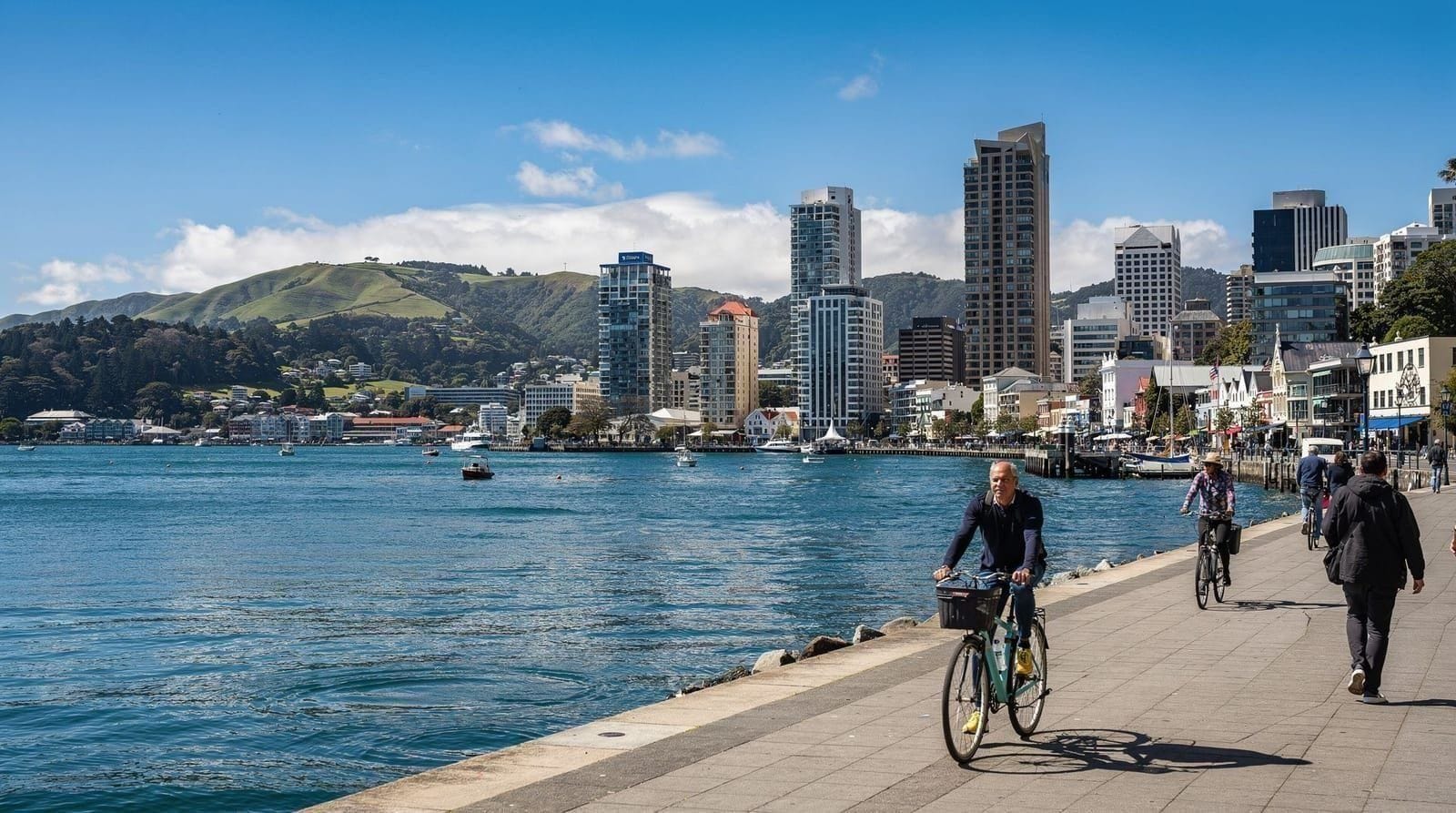
Few New Zealand city waterfronts are as consistently walkable as Wellington’s, running from Te Papa at the southern end, past Frank Kitts Park, and on to Queens Wharf and beyond toward the railway station. This guide lays out a specific route with landmarks, timing and honest notes on where to eat, rather than a vague suggestion to “walk the waterfront.” For the fuller Wellington waterfront destination overview, including nearby accommodation and dining, see our dedicated destination page.
| Where | Te Papa to Queens Wharf, extending to Oriental Bay |
| Cost | Free — no ticket, no booking |
| Time needed | Around 30-40 minutes for the core route, half a day with the Oriental Bay extension and stops |
| Getting there | Walkable from most CBD accommodation |
| Best time | Morning or sunset; check the wind forecast before the full extended walk |
Starting point: Te Papa and Cable Street
The walk naturally starts at Te Papa on Cable Street, whether or not you go inside the museum itself. The plaza outside offers an open first view of the harbour, and it’s a sensible anchor point since most CBD accommodation sits within a short walk of here. Budget the museum visit separately if you’re combining it with the walk — treat this as the walk’s starting landmark rather than a stop along the way.
Frank Kitts Park and the public pools
Heading north from Te Papa, Frank Kitts Park is the walk’s first proper stop, with open lawns, public art installations and — on a warm day — swimmers using the free public pools built into the wharf structures nearby. It’s a genuinely pleasant spot to pause, and one of the few places along the route where sitting down on grass rather than a café chair is a realistic option.
Queens Wharf and the harbour ferry terminal
Continuing north, Queens Wharf is the walk’s practical hub, home to the harbour ferry terminal serving Days Bay and Eastbourne, several cafés and bars, and a cluster of public art. It’s also where several harbour cruise operators depart from, including this commentated harbour explorer tour , a reasonable way to see the same waterfront from the water if you’d rather ride than walk the return leg.
Public art along the route
The waterfront carries one of the city’s densest concentrations of public art, from large-scale sculptural pieces to smaller, easy-to-miss installations tucked along the promenade’s edges. None require a detour — they’re positioned directly along the main walking path — but it’s worth slowing your pace here rather than walking briskly through, since much of the art rewards a closer look than a passing glance provides.
The container port and working harbour
Beyond Queens Wharf, the walk continues past views of Wellington’s working container port, giving a genuine sense of the harbour’s ongoing commercial role rather than a purely scenic, tourist-oriented waterfront. It’s a less conventionally picturesque stretch than the parks and plazas further south, but honest and worth including if you want the fuller picture of how the harbour actually functions.
Where the café warning applies
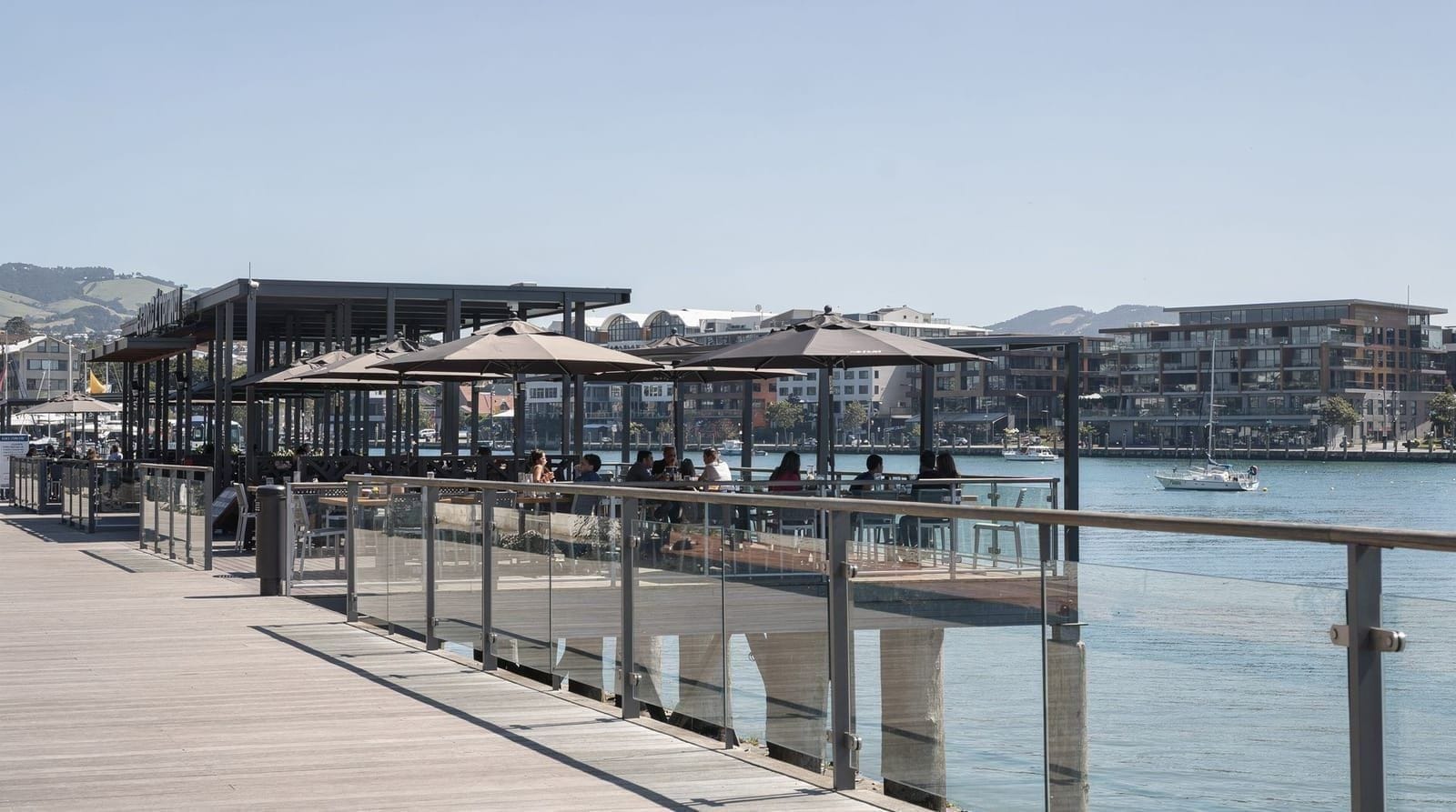
Several cafés directly on the waterfront charge a genuine premium for the view rather than for food quality, and it’s worth knowing this before assuming a waterfront café is automatically a good value stop. Our waterfront café warning names the specific pattern to watch for, and our harbourside dining guide flags which spots along this same route are worth it and which aren’t.
Combining the walk with Oriental Bay
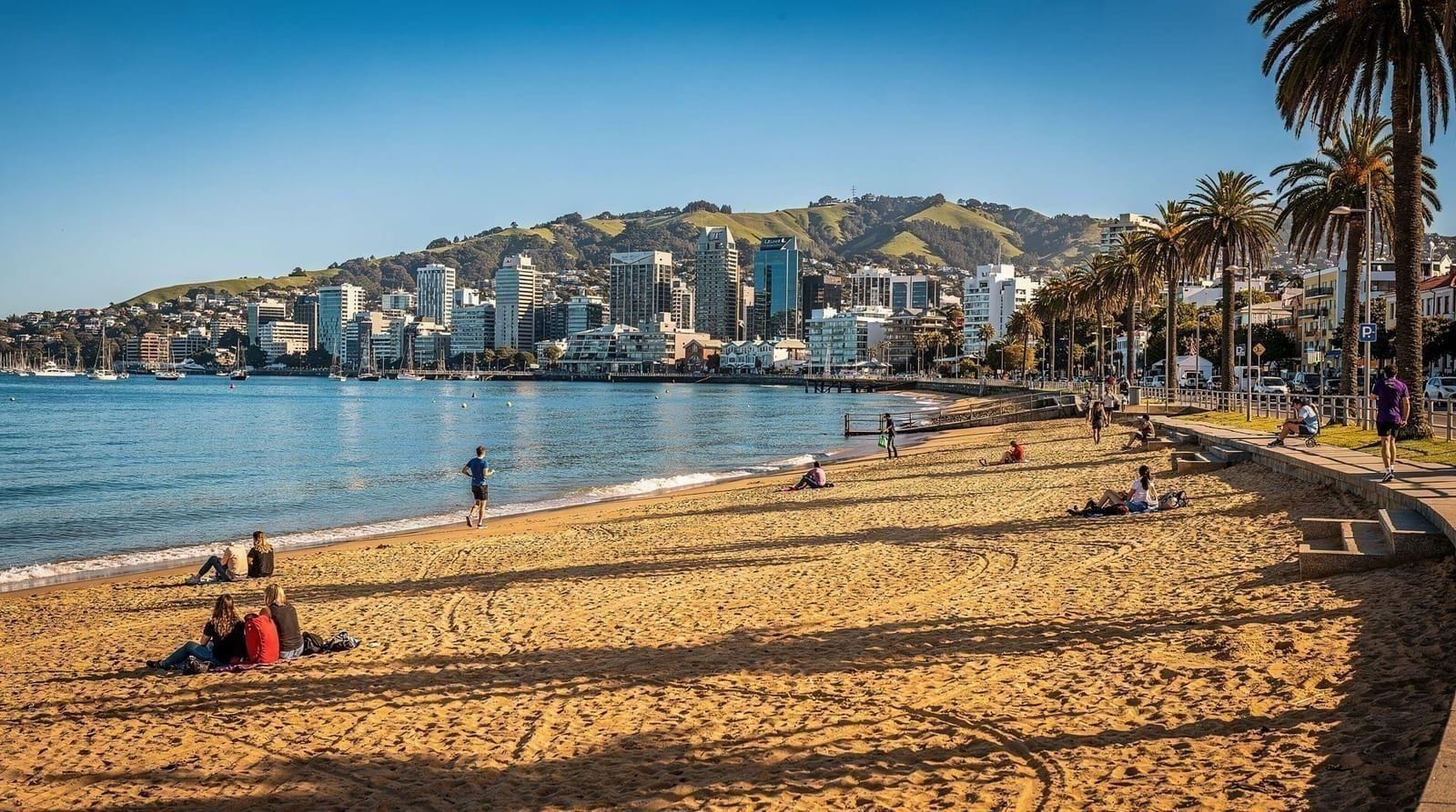
If you continue past the main waterfront stretch, the path leads naturally toward Oriental Bay, Wellington’s closest thing to a city beach, adding a genuinely different character to the walk’s final stretch — sand and swimmers rather than wharves and public art. This extension roughly doubles the walk’s total length, worth it if you have a full afternoon rather than an hour to spare.
How long the walk takes
The core Te Papa-to-Queens Wharf stretch takes about 30-40 minutes at an unhurried pace without stops, though most visitors take considerably longer once café breaks, photo stops and lingering at Frank Kitts Park enter the picture. Extending to Oriental Bay adds another 20-30 minutes each way. Treat the walk as a half-day activity if you’re planning to stop and eat along the way rather than a quick 40-minute there-and-back.
Cycling and alternative ways to cover the route
The same waterfront path doubles as a cycling and scooter route for much of its length, a reasonable option if walking the full extended route to Oriental Bay and back feels like more distance than you want to cover on foot. Several rental operators near the CBD offer bikes or e-bikes by the hour, worth considering if you’re combining the waterfront with a longer loop further along the harbour. For a version that removes the return leg entirely, this e-bike tour with a harbour ferry back rides the waterfront out one way and brings you back across the water, a genuinely different way to cover the same ground than a straightforward there-and-back walk.
Public toilets and facilities along the route
Public toilets are spaced along the route at Frank Kitts Park, near Queens Wharf and at Te Papa itself, so it’s rarely more than a 10-15 minute walk between facilities on the core stretch — worth knowing if you’re walking with young children or simply prefer not to plan a route around uncertainty. Drinking-water refill points are less consistent, so carrying a bottle rather than relying on finding a tap partway along is the safer approach, particularly on a warm day. Bins are frequent enough along the promenade that carrying rubbish for a long stretch generally isn’t necessary.
A shorter version if you’re short on time
If a full 30-40 minute walk doesn’t fit your schedule, the stretch from Te Papa to Frank Kitts Park alone takes closer to 10-15 minutes and still delivers an open harbour view, a stop at the public art and a genuine sense of the waterfront’s character — a reasonable compromise for a tight layover or a wait before a Days Bay ferry departure. It’s a fair substitute for the full route rather than a lesser version of it, if time really is the constraint.
Best time of day to walk
Morning light suits the walk’s public art and open harbour views particularly well, with fewer crowds than the lunch and after-work periods when locals use the same path for exercise and commuting. Evening, particularly around sunset, brings a different but equally worthwhile atmosphere, with the setting sun catching the water and the surrounding hills. Avoid the middle of a hot summer afternoon if you’re walking the full extended route, since the path offers limited shade for much of its length.
Weather and wind along the water
Being directly on the harbour, the waterfront is more exposed to Wellington’s characteristic wind than the more sheltered CBD streets just a block or two inland, and it’s worth checking conditions before committing to the full extended walk on a particularly blustery day. Rain is less of an issue than wind specifically, since the path itself handles wet weather reasonably well, but a genuinely windy day can make the walk considerably less pleasant than the same route on a calmer one.
Combining the walk with other CBD sights
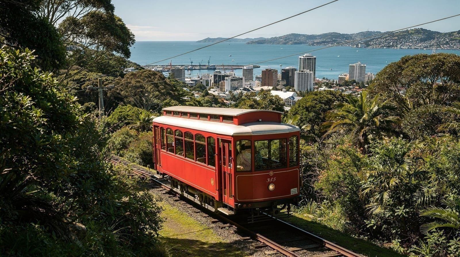
The waterfront walk pairs naturally with a Te Papa visit at one end and Queens Wharf’s ferry terminal at the other, making it easy to build into a broader CBD day alongside the cable car, Cuba Street, or a Days Bay ferry trip. It requires no separate transport booking and no entry fee, making it one of the lowest-effort, highest-value additions to any Wellington itinerary regardless of how many days you have.
The waterfront’s history as reclaimed land
Much of what’s now Wellington’s waterfront sits on land reclaimed from the harbour over more than a century of port expansion, meaning the wharves, warehouses-turned-cafés and public spaces along the walk occupy ground that was open water well into the twentieth century. Several of the older wharf buildings along the route have been adapted from their original industrial function into museums, restaurants and event spaces rather than demolished, giving the walk a genuine layered history alongside its scenic value — the Museum of Wellington’s building, a former harbour board headquarters, is a good example of this adaptive reuse directly on the route. Understanding this history adds context to why the waterfront feels the way it does: a working harbour edge gradually repurposed for public and civic use rather than a purpose-built tourist promenade from the outset.
Swimming and water activities along the route
Beyond the public pools at Frank Kitts Park mentioned earlier, several points along the waterfront are popular with swimmers on warm days, including informal spots near Oriental Bay’s sandier stretch further along the route. Water quality is generally good and monitored, though it’s worth checking current advisories after heavy rain, when stormwater runoff can temporarily affect harbour water quality near the CBD. Paddleboarding and kayaking are also common sights along calmer stretches of the harbour, with rental operators based near the waterfront for visitors who want to get onto the water rather than just walk alongside it.
The waterfront at different times of year
Summer brings the waterfront’s liveliest atmosphere, with swimmers, outdoor diners and considerably more foot traffic than the quieter winter months, when wind and rain make the exposed harbour-front path noticeably less inviting for a leisurely stroll. Autumn (March-May), consistent with the rest of the city’s seasonal pattern, offers a genuinely good middle ground — mild enough for a comfortable walk, without summer’s crowds. Spring brings variable conditions but longer daylight hours, useful if you’re planning an after-work or evening walk rather than a dedicated daytime outing.
Photography along the waterfront
The waterfront offers some of the most consistently good photography opportunities in the city, with the CBD skyline as a backdrop from various points along the walk, the harbour’s changing light throughout the day, and the public art installations providing foreground interest that a plain harbour view alone doesn’t offer. Sunset from the Queens Wharf area, looking back toward the city with the hills silhouetted behind, is a particularly reliable shot. Our best Instagram spots in Wellington roundup covers specific framing suggestions along this same route.
Accessibility of the waterfront walk
The waterfront path is flat, wide and well-paved for its entire length, making it one of the most accessible walking routes in the city for visitors with mobility considerations, pushchairs or wheelchairs — a genuine contrast to some of Wellington’s steeper CBD streets and hillside walks. Public seating is available at reasonably frequent intervals along the route, useful for anyone who needs to pause periodically rather than complete the walk in one continuous stretch.
Combining the walk with a harbour cruise
For visitors who’d rather experience part of the harbour from the water rather than walking its entire length on foot, disembarking a harbour cruise partway along the route and walking the remainder is a reasonable way to combine both perspectives without doubling back on foot. The commentated harbour tour referenced above typically departs from and returns to Queens Wharf, making it straightforward to fold into a walk that starts at Te Papa and finishes back at the same point.
What to bring on the walk
Given the waterfront’s exposure to Wellington’s wind, a windproof layer is worth carrying even on an otherwise mild day, alongside sun protection in summer, since much of the route offers little shade. Comfortable walking shoes matter more than fashion here — the path itself is smooth and easy underfoot, but the distance adds up if you’re extending all the way to Oriental Bay and back. Water is worth carrying in summer specifically, since not every stretch of the route has an obvious place to refill a bottle.
The waterfront and Wellington’s earthquake history
Several of the older buildings along the waterfront carry visible reminders of Wellington’s position on an active tectonic boundary, including strengthened facades and, in some cases, informational plaques explaining specific structural upgrades undertaken after New Zealand’s building codes were tightened following major earthquakes elsewhere in the country. This isn’t something to be alarmed about as a visitor — modern Wellington buildings are built and retrofitted to a high seismic standard — but it’s a genuine part of the waterfront’s story worth knowing, and ties into the earthquake simulator exhibit at Te Papa, which sits directly at the walk’s starting point. Our Wellington earthquake safety for tourists piece covers the practical side of this in more depth if you want reassurance beyond the general “it’s safe” reassurance most visitors receive.
Evening and nightlife along the waterfront
As the day moves into evening, several bars and restaurants along the Queens Wharf stretch shift into a genuinely pleasant evening destination in their own right, with harbour views that hold up well after dark thanks to the CBD’s lit skyline reflecting on the water. It’s a calmer, more scenic alternative to Cuba Street’s livelier nightlife scene if you’d rather end the day with a quieter drink overlooking the harbour than a busier bar strip. Our Wellington nightlife guide covers how the waterfront’s evening scene compares to the CBD’s other nightlife areas.
Combining the waterfront with a rainy-day plan
While the open sections of the waterfront lose some appeal in heavy rain, the walk’s northern end near the railway station and several covered sections near Queens Wharf hold up reasonably well even in wet weather, and the walk can be shortened or adapted to duck into Te Papa, the Museum of Wellington or a covered café at the first sign of a serious downpour. Treating the walk as flexible rather than a fixed, must-complete route makes it considerably easier to adapt around Wellington’s changeable conditions. Our rainy-day things to do guide has the fuller indoor contingency list if the whole afternoon turns wet.
First morning versus last evening: when to walk it
Many visitors use the waterfront walk twice across a multi-day stay — once as an orientation walk on the first morning, getting a physical sense of how the CBD relates to the harbour before diving into specific attractions, and again as a closing walk on the final evening, when the same route feels more reflective than exploratory. Both uses work well precisely because the route requires no booking, no entry fee and no fixed time commitment, making it one of the few Wellington activities flexible enough to bookend a trip rather than needing to be scheduled into a specific day’s plan.
Combining the walk with a wider itinerary
The waterfront walk slots naturally into almost any Wellington itinerary regardless of length — a quick 40-minute version on a one-day stopover, the fuller Oriental Bay extension on a two- or three-day visit, or simply as a recurring evening habit across a longer stay. Our Wellington in 1 day, Wellington in 2 days and Wellington in 3 days guides each reference this same route at different points, since it’s one of the few Wellington activities flexible enough to fit almost any schedule without disrupting the rest of a day’s plan.
Combining the walk with a Days Bay ferry
Queens Wharf’s ferry terminal, mentioned above as the walk’s practical hub, is also the departure point for the harbour ferry to Days Bay and Eastbourne, a genuinely different way to see the harbour once you’ve finished walking its western edge. Timing a coffee stop at Queens Wharf around the ferry schedule, rather than treating the walk and the ferry as two separate outings on two separate days, is a reasonable way to fill an unhurried CBD morning or afternoon. Check the current timetable before you commit, since sailings thin out considerably outside peak times.
Wildlife along the waterfront
The harbour itself is home to more marine life than most first-time visitors expect — keep an eye on the water near the wharves, where fish are occasionally visible in the clear, monitored harbour water, and seabirds are a constant presence along the entire route. Seals turn up in the harbour on an irregular basis and are worth photographing respectfully from a distance if you’re lucky enough to spot one hauled out near a wharf, rather than approaching for a closer look. This isn’t a dedicated wildlife walk the way Zealandia is, but it’s a small, genuine bonus on top of the walk’s main appeal.
Core route vs the Oriental Bay extension
| Core route (Te Papa – Queens Wharf) | Extended route (to Oriental Bay) | |
|---|---|---|
| Time | 30-40 minutes | Adds 20-30 minutes each way |
| Character | Wharves, public art, working harbour | Sand, swimmers, a genuine beach feel |
| Facilities | Frequent — toilets, cafés, seating | Thinner past Queens Wharf until Oriental Bay itself |
| Best for | A quick orientation walk or a stopover | A half-day outing with time to linger |
The bottom line
Wellington’s waterfront walk is free, flat, well-signposted and genuinely rewarding, whether you cover the core 40-minute stretch or extend all the way to Oriental Bay for a fuller half-day outing. It’s one of the easiest ways to get a genuine feel for the city’s relationship with its harbour, and works as well as a first-morning orientation walk as it does a closing evening stroll on your last night in the city.